Sunday, December 28, 2008

Mr. Bike Lane, can we talk?

Michael and I took advantage of another unusually warm day to attempt waterlogging ourselves in the rain. It seems Atlanta is trying to make up for this year's rain deficit all in the last week.

Along Glenwood, a gentleman out for a walk looked over at me and pointed with his arm outstretched toward the curb. I saw no hazard there, but within a moment or two, it occurred to me he was pointing out the bike lane. There was a car about 100 meters back and since we were approaching an intersection where most traffic would turn right, I had moved to the left of the center of the lane in preparation to either let this guy by or prevent him from trying to come around as we were reaching the stop light. Indeed the car did turn right as I expected.

When I looked back to see if the gentleman was still watching, he was gone. He may still be thinking he was right in pointing out that I should have been in the bike lane. I didn't get a chance to send him the URL of the Vehicular Cycling article in Wikipedia. I would have pointed out that the Vehicular Cyclist ignores bike lanes when choosing lane positioning, takes control of the lane when approaching an intersection, and chooses a lane position that indicates their direction of travel. The words about the door zone would have been appropriate as well since along that stretch of curb a few cars had been parked.

What can we do? Misundertanding perpetuated. He could be blogging somewhere about another cyclist who ignores the bike lanes when there is a car behind him.

Don't get me wrong about bike lanes. I like bike lanes for the following reasons:

  • Indicates the road is wide enough that the lane can probably be shared (if the door zone is not also present).
  • Indicates that the road is favored by cyclists. This does two things: 1) alerts drivers they should look for cyclists and 2) helps new cyclists choose appropriate routes.
  • Constricts the lane which encourages slower motor traffic.


What I will do is bring a camera the next time I ride this route. Sorry, this is a subject change.

Our variations on the route took us across a suspension bridge in the woods behind Emory's President's house. This is a good shortcut over to the VA Hospital and Clairmont from Emory's main campus. It is only a single person wide and it is advised to walk bikes (the bridge swings quite a bit), but as you cross South Peachtree Creek, you forget you're in an urban area.

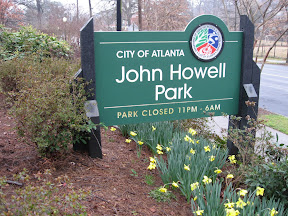
Another variation took us over to the first segment of the Beltline Trail that has been constructed near the historic West End. The signs marking the trail are made from steel rails that resemble the rails the trains run on. Mile Marker 0 is where we started although I did not plan it that way.

When it's dry, I'll come back with the camera to grab some shots.

Ride Summary


Round Trip Distance: 33.0
Number of Cyclists seen: Lost count, but around a dozen.
Route: Variations on Intown Medley; we wanted to stay rather close to home so we could bail if weather conditions got worse.
Weather: Overcast and raining, but low wind, temps in the low 60s

Labels: ,

Friday, October 17, 2008

Density good for Cycling?

Intown Atlanta is going through re-development. Under-utilized properties are planned for more square-footage and that brings more traffic, right? More traffic = bad, right?

The Beltline proposal that was released this past week for the northeast segment argues that density is good and made some good points about how it is good.

For non-local readers, the Beltline is a proposed light rail system that forms a roughly 3-mile radius loop around downtown. It is exciting for the city because this will likely turn into a magnet for new urban development. Parts of this are already being built. My neighborhood Virginia-Highland, borders a northeast stretch of the Beltline.

With the rise of the suburbs, people fled the urban street-scape to find their own piece of land away from it all. To avoid traffic on the street in front of their house, they avoided through streets and thus became dependent on arterial streets to get anywhere. This image shows most trips being made on high-speed and high-capacity roads and thus most likely in a car.


What is proposed is a return to the streets of older cities. This image shows a network of smaller streets that allow multiple paths and encourage lower speeds. These streets are more conducive to both pedestrian and bicycle travel.


Although there are more people -- and probably because there are more people -- the cars are not as threatening because they are forced to travel closer to people speed.

Another factor is the number of cars in a small area motivates drivers to leave their cars behind. Proximity to work, shopping, schools and restaurants -- in short, density -- makes it possible to ditch the car.

Labels: , ,

Friday, February 22, 2008

Early Daffodils

Daffodils are amongst the first flowers to come out of the ground and I'm always happy to see them, but it's rather sad they are opening earlier each year. This is taken today on my commute home from the office.


I have a picture of a daffodil from 1982 that was taken shortly after St. Patrick's Day (March 17th). That date is nearly 4 weeks earlier than it was 26 years ago.

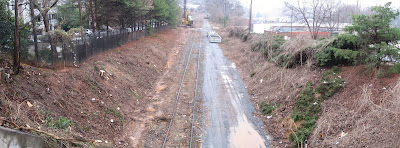
On the same walk, I passed a stretch of the Beltline right-of-way. The brush has been cleared, but I'm not sure what is being prepared. This is looking south from Virginia Avenue. It's clear that there is room for a pedestrian trail alongside light rail along this stretch.


Commute Summary


Round Trip Distance: 5.0 (walking)
Weather: Raining all day long (fill that reservoir)

Labels: ,

Monday, February 11, 2008

A Ride along the Beltline

OK, the Beltline has just begun construction, but it doesn't mean we can't ride through the neighborhoods near the Beltline's proposed route.

The Atlanta Bicycle Campaign is sponsoring a bike tour Sunday April 20 along a southern stretch from the corner of Virginia-Highland over to where the construction has started.

This ride is one of the local Family Rides coming up this Spring. Details are found on ABC's website: http://atlantabike.org

Many lament the lack of facilities, but it's rides like these that show there's already a ground-swell of cyclists, courteous motorists, and suitable routes. We're reaching a tipping point.

Labels: , ,

Wednesday, May 02, 2007

Building Communities Less Dependent on the Car


Much industrial land in Intown Atlanta is currently being converted to multi-unit residential. Although Atlantic Station has grabbed Atlanta's spotlight for being a converted steel mill property, there are several smaller tracts that are turning residential. The pictured construction is along the planned Beltline. You can see the vine-covered abandoned rail running from bottom center upward to the right which is planned to become an alternative transportation corridor.

I don't know if this property is billed as less car-intensive, but it's close to downtown, and close to the PATH Foundation's Freedom Park Trail (I'm standing on the trail to take these photos). Restaurants are a short stroll away and you're within a couple of miles of most things you would shop for.

Many residents of single-family housing fear the number of cars higher-density might bring, but our mass transit needs this density to work efficiently. We're moving over the hump with this new development.

I was also standing on the trail to take this photo alongside Candler Park Golf Course's 9th tee box.


Commute Summary


Round Trip Distance: 17.9
Number of Cyclists seen: 19
In-bound Route: Lullwater/PATH
Out-bound Route: Emory via Clifton
Weather: Beautiful Morning, Warm and Hazy afternoon

Labels: , , ,